Pushed to the Margins: How Storms and Sprawl Are Rewriting Puerto Rico's Rural Map
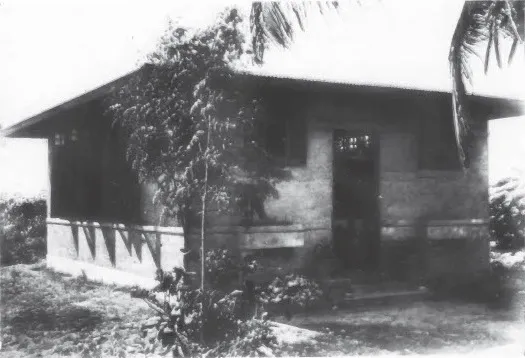
Photo: Adrian C. Finlayson, Architect for the Insular Department of the Interior, Public domain, via Wikimedia Commons
There's a particular kind of quiet that settles over a town that's losing people. Houses sit with their shutters nailed shut. Colmados that once buzzed with conversation close early, then stop opening at all. Roads that used to carry school buses now mostly carry memories.
This is happening across Puerto Rico's rural interior — and the reasons go deeper than a struggling economy or the well-documented wave of migration to the US mainland. What's reshaping these communities is something more elemental: geography itself. The island's position in the Atlantic hurricane corridor, combined with intensifying development pressure along its coasts, is pushing rural populations around in ways that are only beginning to be fully understood.
Where the Storms Come From
Puerto Rico sits almost perfectly in the path of Atlantic tropical systems. Hurricanes forming off the west coast of Africa track westward across warm open water, and the island — roughly 100 miles long and 35 miles wide — offers very little room to dodge. When a major storm makes landfall or passes close, there's nowhere to hide.
The 2017 Atlantic hurricane season made this brutally clear. Hurricane María didn't just destroy infrastructure. It exposed how differently geography distributes risk across the island. Communities in the mountainous interior — places like Utuado, Jayuya, and Comerío — were cut off for weeks when roads washed out and bridges failed. Rivers swelled beyond recognition. Entire hillside neighborhoods slid into valleys below.
The damage wasn't random. It followed the island's topography with ruthless precision. Steep terrain that had once sheltered communities from coastal storms became a liability when rainfall totals exceeded what the landscape could absorb. In Utuado, some residents went without power for nearly a year. In Comerío, the Río La Plata rose so fast that people had hours — sometimes less — to get out.
The Slow Drain Before the Storm
Here's the thing though: the displacement didn't start with María. The storm accelerated a process that had been underway for decades.
Puerto Rico's rural municipalities have been losing population since at least the 1970s. Centrales — the sugar mills that once anchored entire regional economies — closed one by one as the industry collapsed. Without those jobs, younger generations left for San Juan, for Orlando, for New York. What remained were older residents, smaller farms, and communities held together more by stubbornness and loyalty than by economic opportunity.
Meanwhile, coastal areas were booming. The metropolitan zone around San Juan expanded steadily southward and eastward. Municipalities like Guaynabo and Toa Baja became suburban extensions of the capital, filling in with residential developments, shopping centers, and commercial corridors. The coast — despite its own very real hurricane exposure — attracted investment and population in ways the interior simply couldn't match.
This created a geographic paradox. The places most economically vibrant were often the most physically exposed to storm surge and coastal flooding. The places with more natural protection from wind and water were the ones bleeding residents.
Case Study: Comerío's Long Road Back
Comerío is a good place to sit with this contradiction for a while. Located in the island's north-central interior, it's the kind of municipality that geography textbooks would call "inland" — protected from direct coastal exposure, surrounded by hills, bisected by rivers. In theory, a safer place to live than, say, a low-lying coastal community.
But theory and practice diverge here. The same rivers that give Comerío its agricultural character also make it catastrophically flood-prone during major rain events. After María, roughly 70,000 people island-wide were displaced from their homes at various points. Comerío's residents were among the hardest hit. Some left temporarily. Many never came back.
The municipality's population had already been declining — around 19,000 people before María, down from higher mid-century counts. Post-storm estimates suggest further losses, though tracking exact numbers in the years immediately following a disaster is notoriously difficult. What's clear is that the storm gave people who were already considering leaving a final push. And the geographic isolation that made recovery so slow made the decision to go even easier to justify.
Development Pressure as a Displacement Force
Coastal urbanization works differently than hurricane displacement, but the end result — rural communities losing people and coherence — is often the same.
As San Juan's metro area expanded, land values in previously rural municipalities climbed. Families that had farmed the same plots for generations suddenly found themselves fielding offers from developers. Some sold. Others held on until property taxes rose to the point where holding on became impossible. The geography of affordability shifted, pushing lower-income residents further from economic centers even as those centers sprawled outward toward them.
Municipalities in the island's northeastern corridor — Loíza, Canóvanas, and parts of Carolina — have experienced this pressure acutely. These communities have deep Afro-Puerto Rican roots and complex cultural geographies. As development encroaches, the question of who gets to stay becomes inseparable from questions of race, class, and historical marginalization.
Loíza in particular has drawn attention from researchers and advocates studying environmental justice. It sits at the intersection of coastal flood risk, underfunded infrastructure, and real estate pressure — a convergence that makes it one of the most geographically vulnerable communities on the island.
What Settlement Patterns Are Starting to Look Like
Take a step back and look at the island's demographic shifts over the past two decades, and a pattern starts to emerge. Population is concentrating in a narrower band of municipalities — mostly in the northeastern metro zone and a few mid-sized regional centers like Ponce and Mayagüez. The rural interior is thinning out. Coastal areas are densifying in some places and hollowing out in others, depending on whether they're attracting investment or absorbing risk.
This isn't unique to Puerto Rico — rural depopulation is a global phenomenon. But the island's compact geography and its position in one of the world's most active hurricane corridors give the process a particular intensity. There's less room for gradual adjustment. When a storm hits, change happens fast.
Geographers and urban planners who study the island talk about the need for what they call "managed retreat" — a planned, supported process of moving people out of the highest-risk areas rather than waiting for disasters to do it violently. It's a concept that makes sense on paper and faces enormous resistance in practice, because it asks people to leave places they love.
The Human Side of Geographic Change
Behind every demographic shift is a person making a decision — usually a hard one. A farmer in Jayuya deciding whether to rebuild after the third flood in ten years. A family in Loíza weighing a developer's offer against the neighborhood they grew up in. A young person from Comerío choosing between staying close to aging parents or chasing work in a city that doesn't quite feel like home.
Geography shapes the conditions of those decisions in ways that aren't always visible. The slope of a hillside, the path of a river, the distance from a highway — these physical facts carry enormous social weight. They determine who stays, who goes, and who gets left behind.
Puerto Rico's rural communities have survived a lot. Colonial extraction, economic collapse, political limbo, and successive catastrophic storms. Whether they can survive the current combination of climate pressure and development sprawl is one of the more important geographic questions the island faces right now. And the answer is going to look different in every municipality, on every hillside, along every flooding river.
That's the thing about geography. It's never really abstract.