Water From the Mountains: Understanding Puerto Rico's Watershed Geography
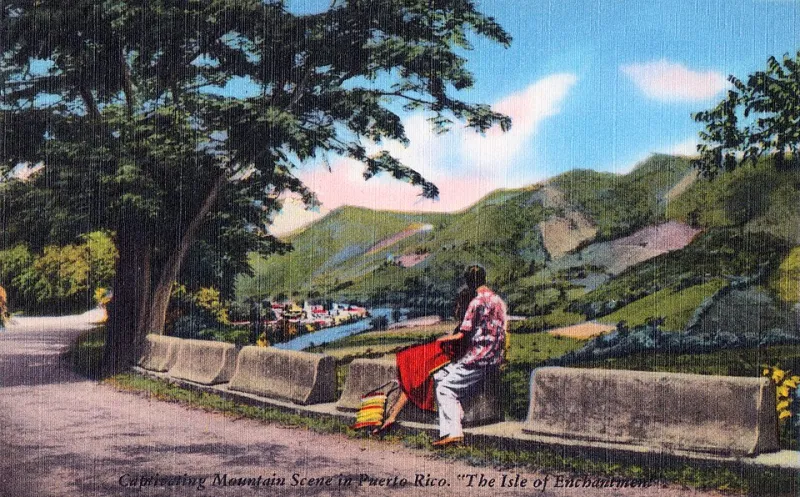
Photo: Published for Matias Photo Shop, San Juan by Tichnor Brothers, Boston, Public domain, via Wikimedia Commons
Spread a topographic map of Puerto Rico on a table and the first thing you notice is the spine. Running east to west through the heart of the island, the Cordillera Central rises sharply from the coastal plains, with peaks pushing past 4,000 feet. It's a dramatic landscape for an island only about 100 miles long — and it creates something equally dramatic: a network of rivers and streams that drain outward in every direction, feeding communities, ecosystems, and coastlines across the entire island.
This is Puerto Rico's watershed geography, and understanding it is basically a master class in how physical landscapes shape human life.
What Is a Watershed, Exactly?
Let's start with the basics, because "watershed" is one of those words that gets thrown around a lot but doesn't always get explained. A watershed is simply the area of land that drains into a particular body of water. Think of it like a bathtub: every drop of rain that falls inside the tub eventually flows toward the drain. The tub's walls are the watershed boundaries — called divides — and everything inside them is connected by water.
In Puerto Rico, the central mountain range acts as the great divide. Rain falling on the north slope flows toward the Atlantic. Rain falling on the south slope flows toward the Caribbean. The island has over 50 named rivers and hundreds of smaller streams, most of them relatively short and steep — dropping quickly from high elevations to the coast in a matter of miles. That steepness means water moves fast, which has big implications for both flooding and water supply.
The North vs. South Divide
One of the most striking things about Puerto Rico's watershed geography is the contrast between the island's two coasts — a contrast that's almost entirely driven by topography and the direction of trade winds.
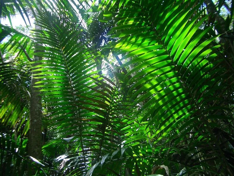
The north coast receives the brunt of moisture-laden trade winds blowing in from the Atlantic, and the mountains force that air upward, cooling it and triggering rainfall. The result: lush, wet landscapes on the northern slopes, with rivers that run year-round. El Yunque National Forest, tucked into the northeastern corner of the island, receives up to 200 inches of rain per year in its highest elevations. The rivers draining this region — like the Río Espíritu Santo and the Río Mameyes — are relatively reliable water sources and support extraordinary biodiversity.
Flip to the south coast and the picture changes completely. The mountains block much of that Atlantic moisture, creating a pronounced rain shadow. Southern rivers like the Río Jacaguas and the Río Coamo run through dry scrubland and are often intermittent — flowing strongly after storms but slowing to a trickle during dry months. Historically, southern communities built elaborate reservoir and irrigation systems to manage this scarcity. Water on the south coast isn't just a geographic feature; it's always been a political and economic one.
Rivers as Community Lifelines
Puerto Rico's rivers aren't just scenic. They're infrastructure. The island relies heavily on surface water — rivers and reservoirs — for its drinking water supply, and the health of those water sources is directly tied to what's happening in the watersheds above them.
When forests are cleared for development or agriculture on upper slopes, sediment washes into rivers during rainstorms, clogging water treatment systems and reducing reservoir capacity. When wetlands along river corridors are filled in for construction, the natural filtration and flood-buffering functions those wetlands provide disappear with them. Every land-use decision made in a watershed — even miles from the nearest river — has downstream consequences, sometimes literally.
The Río La Plata, which drains a large portion of the north-central interior and supplies water to much of the San Juan metropolitan area, is a good example. Its watershed stretches across a patchwork of forests, farms, suburban development, and industrial zones. Managing water quality in that river means managing land use across a huge and varied landscape — a challenge that requires cooperation across municipal boundaries and competing economic interests.
Hurricane Resilience and Watershed Health
Hurricane Maria in 2017 provided a brutal real-world demonstration of how watershed geography affects disaster resilience. The storm dumped catastrophic rainfall across the island in a matter of hours — in some areas, more than two feet of rain fell in a single day. Rivers overwhelmed their banks, bridges washed out, and landslides tore down slopes that had lost tree cover.
The communities that fared worst were often those in low-lying areas at the bottom of degraded watersheds — places where upstream deforestation had increased runoff, where floodplains had been built over, and where there was nothing left to slow the water down. The communities with healthier surrounding forests and intact riparian buffers (the strips of vegetation along riverbanks) saw less catastrophic flooding, even under the same rainfall totals.
This isn't a coincidence. It's physics. Trees intercept rainfall, letting it soak slowly into the soil rather than racing across the surface. Root systems hold slopes together and prevent landslides. Wetlands act like sponges, absorbing floodwaters and releasing them gradually. A healthy watershed is, in a very real sense, a flood-management system — one that took thousands of years to build and can be dismantled in a single construction season.
The Coast at the End of Every River
Every watershed in Puerto Rico ends at the sea, and the health of coastal ecosystems is deeply tied to what arrives there via rivers. Freshwater flows, sediment loads, and nutrient levels in coastal waters all influence the coral reefs, seagrass beds, and mangrove forests that line Puerto Rico's shores.
Mangroves, in particular, sit right at this mountain-to-coast junction. These salt-tolerant trees thrive in the brackish zone where rivers meet the sea, and they depend on a balance of fresh and saltwater inputs that healthy watersheds help maintain. When rivers are dammed, diverted, or run dry, mangroves suffer. When they're flooded with excess sediment from eroded uplands, they suffocate. The connection between a cloud forest in the Cordillera Central and a mangrove bay on the coast is real — it just plays out over miles and months rather than minutes.
Why This All Matters to You
Whether you're a student trying to understand how island geography works, a traveler exploring Puerto Rico's rivers and coastlines, or someone with family ties to communities across the island, the watershed story is ultimately about connection. The mountains, the rivers, the farms, the cities, and the reefs aren't separate things — they're one continuous system, linked by water.
Protecting that system means thinking beyond property lines and municipal boundaries. It means recognizing that the decisions made in the highlands of Utuado or Jayuya ripple all the way to the fishing communities of Cabo Rojo or the beaches of Luquillo. In a place as geographically compact and ecologically complex as Puerto Rico, that kind of systems thinking isn't just good science — it's essential survival knowledge.