One Island, Many Worlds: The Science Behind Puerto Rico's Wildly Different Climate Zones
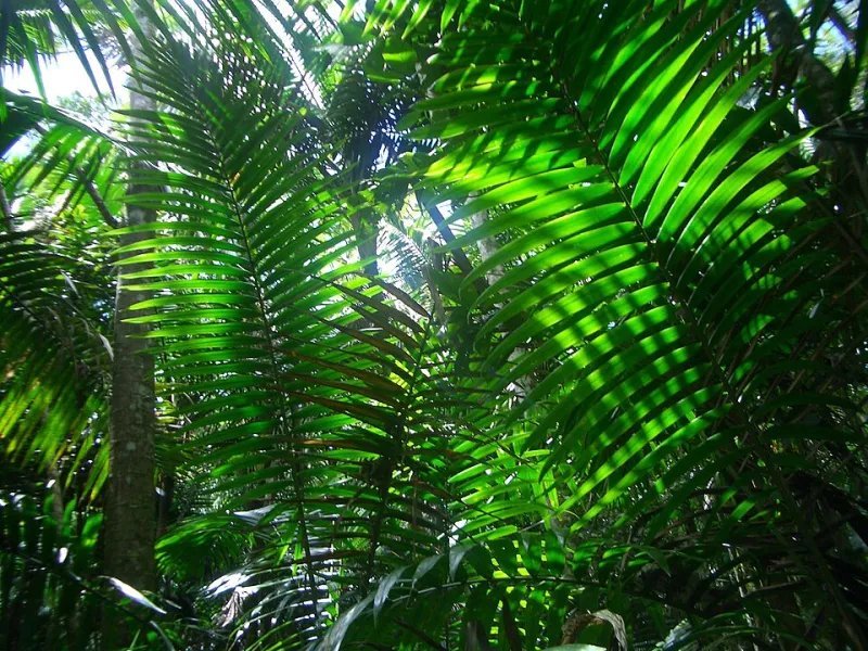
Photo: EgorovaSvetlana, CC BY-SA 4.0, via Wikimedia Commons
Imagine driving two hours in a straight line and passing through the equivalent of multiple climate zones—wet, misty forest giving way to scrubby, sun-baked terrain that looks more like New Mexico than the Caribbean. That's not a thought experiment. That's just a Tuesday in Puerto Rico.
For anyone who's only experienced the island through a resort brochure, this might come as a surprise. Puerto Rico isn't just one kind of tropical paradise. It's several, stacked together on a 35-by-100-mile stretch of land. And the geographic forces responsible for that variety are just as fascinating as the landscapes themselves.
The Trade Wind Effect: Nature's Climate Divider
To understand why Puerto Rico's north and south feel like completely different worlds, you have to start with the trade winds. These steady easterly winds blow across the Atlantic and hit the island's northeastern coast almost year-round. When they do, they carry warm, moisture-laden air inland—and that air has nowhere to go but up.
Puerto Rico's interior is dominated by the Cordillera Central, a mountain spine that runs roughly east to west across the island. As humid air rises over these mountains, it cools, condenses, and releases enormous amounts of rainfall on the northern and eastern slopes. This is called orographic lift, and it's the same basic process that makes the Pacific Northwest so rainy compared to eastern Oregon.
By the time that air crests the mountains and descends toward the southern coast, it's lost most of its moisture. What arrives on the southern side is drier, warmer, and far less inclined to produce rain. Meteorologists call this a rain shadow effect. Puerto Ricans call the south coast home to some of the most striking arid landscapes in the entire Caribbean.
El Yunque: Where the Rain Never Really Stops
The most famous expression of Puerto Rico's wet side is El Yunque National Forest, the only tropical rainforest managed by the U.S. Forest Service. Tucked into the northeastern corner of the island in the Sierra de Luquillo mountains, El Yunque receives somewhere between 100 and 200+ inches of rainfall per year depending on elevation—with the highest peaks sometimes exceeding that upper range.
For context, Seattle—America's go-to symbol of relentless rain—averages around 38 inches annually. El Yunque gets more than five times that.
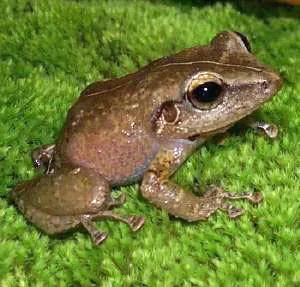
The result is a landscape that feels almost otherworldly. Massive ferns, bromeliads clinging to tree trunks, and a constant mist that softens every view. The forest is stratified into distinct layers: the forest floor, the understory, the canopy, and the cloud forest near the peaks, each supporting its own community of plants and animals. Many of those species, including Puerto Rico's beloved coquí frogs, exist nowhere else on Earth.
For students studying ecology or biogeography, El Yunque offers a near-perfect case study in how rainfall totals shape entire ecosystems from the ground up.
The Southern Coast: Desert by Another Name
Drive south through the mountains and the change hits you fast. The vegetation thins. The soil lightens. Cacti start appearing roadside. By the time you reach towns like Guánica or Ponce, you're in territory that receives less than 30 inches of rain per year—technically classified as a tropical dry forest or semi-arid zone.
Guánica Dry Forest, a UNESCO Biosphere Reserve on the southwestern coast, is one of the best-preserved tropical dry forests in the world. It looks nothing like El Yunque. The trees are shorter, many of them deciduous (yes, trees that lose their leaves in the tropics), and the ground cover is sparse and thorny. Birdwatchers love it because it harbors species that simply don't exist in wetter parts of the island.
The contrast between Guánica and El Yunque—separated by maybe 60 miles as the crow flies—illustrates something important about Caribbean geography: island size doesn't determine climate complexity. What matters is topography, wind patterns, and ocean proximity. Puerto Rico has all three working in dramatic ways.
The In-Between Places: Karst Country and Coastal Zones
Puerto Rico's climate story doesn't end at two extremes. The island's northwest is dominated by a karst landscape—a terrain of limestone hills, sinkholes, and underground rivers shaped over millions of years by slightly different rainfall patterns and the chemical dissolution of rock. Towns like Arecibo and Barceloneta sit near this zone, where the land itself has been sculpted by water in ways that are visually unlike anywhere else in the U.S. territories.
The coastal areas, meanwhile, experience a moderating effect from the ocean. Sea breezes keep temperatures more stable than the interior, and humidity stays high even on the drier southern coast. This maritime influence is why Puerto Rico's temperatures rarely swing dramatically—the island stays in a relatively narrow band between the low 70s and low 90s Fahrenheit throughout the year.
For travelers, these microclimatic differences are practically useful. Planning a hike in El Yunque? Bring a rain jacket no matter what the forecast says. Visiting Ponce or the southern coast in winter? You might be surprised by how dry and warm it feels compared to San Juan.
What Puerto Rico Teaches Us About Caribbean Geography
Puerto Rico is sometimes treated as a single dot on a map, but it's really a miniature continent of climate variation. And it's not unique in this among Caribbean islands—Hispaniola, Jamaica, and Dominica all show similar patterns of orographic rainfall and rain shadow effects. What makes Puerto Rico especially valuable as a geography lesson is its accessibility for U.S. students and the quality of scientific research conducted there.
The island has been a site for climate monitoring, hurricane research, and ecological study for decades. Its position in the northeastern Caribbean, directly in the path of Atlantic trade winds and hurricane tracks, makes it a natural laboratory.
When you understand why it rains 180 inches a year in one corner of Puerto Rico and barely 25 in another, you start to see the whole Caribbean differently. You realize that "tropical" isn't a single thing—it's a category that contains multitudes. And Puerto Rico, small as it is on the map, contains more of those multitudes than almost anywhere else in the region.