Off the Books and Into the Hills: How Puerto Rico's Terrain Built a Parallel Economy
Every island has its workarounds. But Puerto Rico's workarounds have geography baked into them in ways that are genuinely fascinating — and almost entirely absent from the economic data that shapes how Washington and San Juan talk about the island's financial health.
From the limestone karst corridors of the northwest to the isolated fishing villages tucked along the eastern coast, the physical layout of Puerto Rico has always created conditions where informal commerce doesn't just survive — it thrives. Understanding why means starting with the land itself.
When the Map Becomes a Business Plan
Puerto Rico is not a flat, easily traversed place. The Cordillera Central runs like a spine through the island's interior, cutting off municipalities from each other and from the capital in ways that still matter today. Even with modern roads, towns like Maricao, Adjuntas, and Jayuya sit in geographic pockets that have historically operated with a degree of economic autonomy that lowland cities simply don't experience.
That isolation isn't just inconvenient — it's generative. When formal supply chains are slow, expensive, or unreliable, local alternatives emerge. Mountain communities developed their own micro-economies around agricultural goods, handmade products, and barter-adjacent systems long before anyone coined the term "informal economy." The terrain made centralized economic control difficult, and local ingenuity filled the gap.
This isn't a Puerto Rico-specific story, of course. Mountainous regions around the world — from Appalachia to the Andes — show similar patterns. But Puerto Rico's particular combination of size, topographic variation, and political status creates a version of this dynamic that's especially layered.
Coastlines That Were Never Just for Swimming
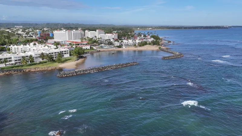
Shift your attention to the coast and the geography of informal commerce takes on a different character entirely. Puerto Rico has roughly 311 miles of coastline, and not all of it is lined with resorts and Coast Guard stations. The island's southern and western shores in particular include coves, shallow inlets, and low-traffic stretches that have historically served as points of entry for goods moving outside official customs channels.
Smuggling is an old story in the Caribbean — it predates the United States' involvement by centuries. During the Spanish colonial period, Puerto Rican merchants routinely traded with non-Spanish ships in defiance of crown regulations, using exactly the kinds of remote coastal geography that made enforcement nearly impossible. The British, Dutch, and Danish islands nearby were close enough and accessible enough that informal trade across colonial boundaries was practically a local industry.
Fast-forward to the 20th century and the economic pressures change but the geography doesn't. Periods of heavy federal taxation on certain goods, combined with the island's proximity to the Dominican Republic, Haiti, and the Virgin Islands, kept the logic of coastal informal trade very much alive. The specific goods shift depending on what's expensive or restricted at any given moment, but the underlying geographic enabler — a long, partially monitored coastline close to other jurisdictions — remains constant.
What "Informal" Actually Means Here
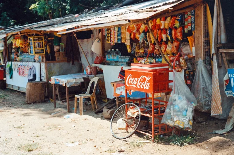
It's worth pausing on the word itself, because informal economy covers an enormous range of activity. At one end, you have entirely legal but unregistered commerce: the neighbor who fixes cars in his driveway, the woman selling pasteles out of a cooler near the plaza, the farmer who sells produce directly from the back of a truck on Route 2. None of this involves anything illegal, but none of it shows up in official GDP figures either.
At the other end, you have genuinely underground trade — contraband goods, unreported cash transactions in industries that are nominally regulated, and the movement of products that skirt both U.S. federal and Puerto Rican local law.
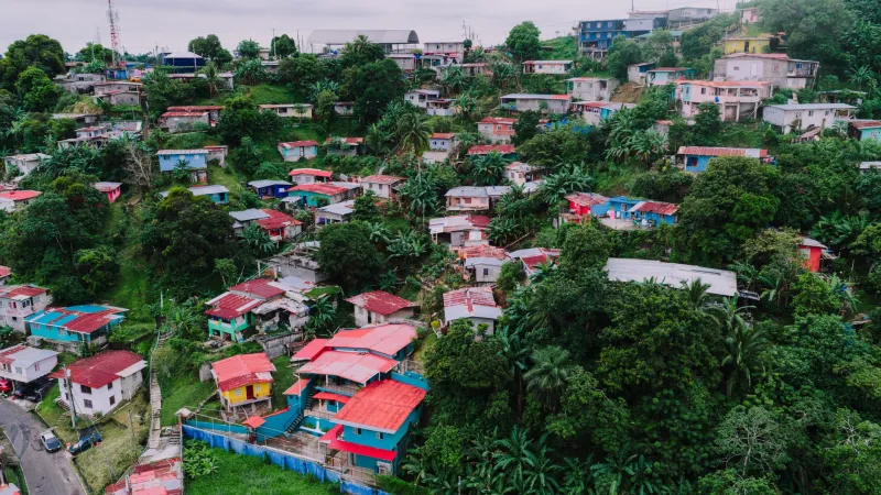
The geography of the island influences both ends of this spectrum. Rural municipalities with lower incomes and less economic infrastructure tend to have higher concentrations of informal-but-legal commerce simply because formal business infrastructure — banking, licensing, commercial real estate — is less accessible there. The mountains and their isolation aren't causing poverty, but they are shaping how economic activity adapts to it.
The Municipalities That Fell Through the Cracks
Consider the geographic distribution of Puerto Rico's 78 municipalities. The island's economic activity is heavily concentrated in the northeastern corridor — San Juan, Bayamón, Carolina, Caguas — where infrastructure is dense and formal employment is most available. But municipalities like Culebra and Vieques, separated from the main island by water, or interior towns cut off by mountain passes, operate in a different economic reality.
Vieques is a useful case study. For decades, the U.S. Navy's presence on the island's eastern two-thirds severely constrained economic development. When the Navy left in 2003, the formal economy didn't automatically rush in to fill the void. Geographic isolation — Vieques sits about eight miles off Puerto Rico's east coast and requires a ferry or small plane to reach — meant that informal networks of exchange, mutual aid, and off-the-books commerce remained deeply embedded in daily life long after official restrictions lifted.
That's not unique to Vieques. It's a pattern you see repeated across geographically marginal parts of the island, where the distance from economic centers creates conditions that formal markets are slow to address.
What the Numbers Don't Say
Economists who study Puerto Rico's fiscal situation — and there are many of them, especially since the 2016 debt crisis — frequently note that official GDP figures likely undercount actual economic activity on the island. Estimates of informal economic activity in Puerto Rico range widely, but some analyses suggest it could account for anywhere from 20 to 30 percent of real economic output, depending on methodology.
That gap matters enormously when policymakers are making decisions about austerity measures, federal aid, or investment priorities. If a significant portion of how Puerto Ricans actually sustain themselves is invisible to official measurement, then policy built on those official numbers is working from an incomplete map — literally and figuratively.
Geography is part of why that gap exists. The same terrain features that made centralized control difficult for Spanish colonial administrators make comprehensive economic monitoring difficult today. You can't easily count what happens in a mountain town's weekend market or along a quiet stretch of southwestern coastline.
The Landscape as Economic Actor
What makes Puerto Rico's informal economy particularly interesting from a geographic perspective is that the terrain isn't just a backdrop — it's an active participant. The karst region's cave systems, the mountain passes, the coastal inlets: these aren't just scenic features. They're infrastructure. They've functioned as infrastructure for informal commerce for as long as people have lived on the island.
That doesn't make informal trade romantic or consequence-free. Underground commerce carries real costs — tax revenue that doesn't fund public services, labor protections that don't apply, environmental oversight that doesn't happen. But it does mean that any honest accounting of Puerto Rico's economic geography has to include the parts of the map that official data tends to skip over.
The island's informal economy isn't a failure of the system. It's a response to geography, history, and political circumstance that the system was never fully designed to accommodate. Understanding that starts with looking at the land.