Eight Towers, One Island: Driving the Spanish-Era Lighthouse Ring From Cabo Rojo to Fajardo
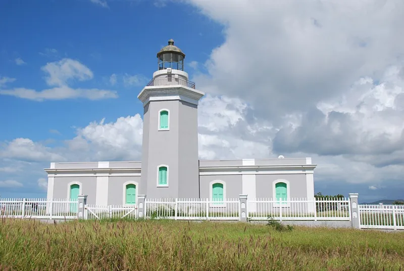
Photo: ForgottenColorado, CC BY-SA 4.0, via Wikimedia Commons
Stand on the bluff at Cabo Rojo at sunset and you can see the problem the Spanish Empire spent a fortune solving. The limestone cliffs drop straight into churning water, the trade winds funnel around the point, and for centuries, ships rounding this corner had nothing but hope between them and the reef.
Then, in the 1880s and 1890s, Spain built a chain of lighthouses around Puerto Rico — a ring of light meant to make the island's coast navigable from any direction. Most still stand. Several are open to visitors. And strung together, they form one of the best road-trip frameworks on the island: a week-long loop that doubles as a crash course in maritime geography.
Why the Lighthouses Sit Where They Sit
The locations aren't decorative. Every tower marks a specific hazard: a reef-studded shallows, a river mouth that silted unpredictably, a cape where currents converge. If you want to understand Puerto Rico's coastal geography, the lighthouses are annotated versions of the map itself.
The southern coast's towers guard the approaches to the old sugar and salt ports. The northern ones warn of the island's longest beaches and shifting sandbars. The easternmost light watches the passage to Vieques and Culebra, where the seafloor drops into some of the deepest water in the region.
The Route, Counterclockwise
Start: Faro Los Morrillos, Cabo Rojo. The red-brick tower perched on white cliffs at the island's southwest corner is the most photogenic of the bunch — and the windiest. The walk out is short and hot; the payoff is a 200-foot view of the Caribbean.
Next: Faro Punta Borinquen, Aguadilla. Built partly from the ruins of an old Spanish fort, this one sits near the old Ramey Air Force base, a reminder of how military geography keeps layering on the same strategic coastline.
Then: Faro de Arecibo. Inland slightly, on a bluff above the Río Grande de Arecibo. It's the rare lighthouse you can pair with a cave country detour — the limestone country around it is some of the island's most geologically interesting terrain.
Finish: Faro Las Cabezas de San Juan, Fajardo. At the island's northeastern tip, this restored 1882 tower sits inside a nature reserve where dry forest meets mangrove meets bioluminescent lagoon. Book the guided tour in advance — access is limited, and for good reason.
Between endpoints, you'll pass El Faro de Punta Tuna in Maunabo on the southeast coast — a lonely, gorgeous tower that most rental-car itineraries skip, which is exactly why you shouldn't.
A Week Is Enough
The full loop is roughly 350 miles of driving, but the island's compact size means no single leg exceeds three hours. A sensible pace: two nights on the west coast, one in the northwest, one in the interior, and two on the east. Fuel up in towns, not along the expressways, and remember that the coastal roads on the south side are the slowest — and the prettiest.
Reading the Coastline Like a Sailor
Here's the educational payoff for teachers and geography nerds: the lighthouse ring is a 19th-century hazard map you can drive. Each tower tells you where ships wrecked, where ports thrived, and where the seafloor turns hostile. Puerto Rico's economy, settlement patterns, and even its dialects of coastal life all trace back to the same navigational geography these lights were built to tame.
The Spanish built the ring to serve an empire. Today it serves something better — a self-guided tour of the island's edges, told one lighthouse at a time.