Say 'Across the Island' and You've Explained Puerto Rico: A Case for Terrain-First Thinking
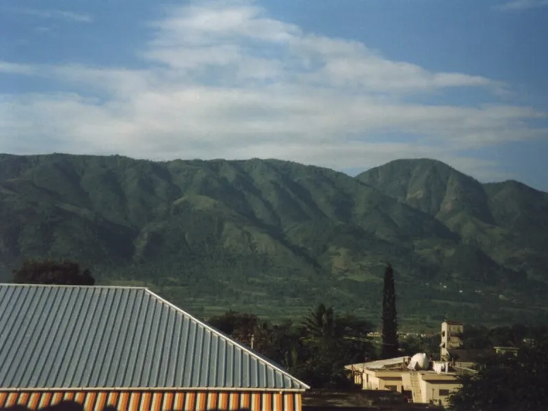
Photo: Treeman, Public domain, via Wikimedia Commons
Listen closely the next time Puerto Ricans describe travel on their island, and you'll catch a detail most guidebooks miss. Nobody goes around the island. They go across it. From San Juan to Mayagüez. Across to Ponce. The phrasing isn't an accident, and if you take it seriously, it reframes a lot of what outsiders find puzzling about Puerto Rico — including the famous tension between the metro area and what everyone simply calls la isla.
The Spine Runs Down the Middle
Geographically, the reason is obvious the moment you look at a relief map. Puerto Rico is an elongated island, roughly 100 miles east to west and only about 35 miles at its widest north to south. Running down its center is the Cordillera Central, a mountain spine that, together with its eastern extension toward El Yunque, divides the island into a windward north and a leeward south.
That means nearly every meaningful trip on the island is a crossing — over the mountains, through the interior, from one coast to the other. The verb is baked into the terrain.
Why 'La Isla' Means Everywhere but San Juan
Here's where the language gets pointed. When people in San Juan say they're going to la isla — "the island" — they don't mean the whole island. They mean everything else: the interior towns, the south coast, the west. The capital, sitting on the flat coastal plain where the mountains are farthest away, has effectively annexed the term for itself.
You could read that as pure snobbery, and some of it certainly is. But there's a physical logic underneath. San Juan grew into the island's dominant city partly because geography let it: a broad, flat, harbor-rich coastal plain, facing the Atlantic and the trade winds, with easy road-building terrain in every direction. The interior and southern towns, by contrast, spent centuries on the far side of a mountain range. Until modern highways punched through the Cordillera, a trip from San Juan to Ponce was a serious expedition, not an errand.
Distance across mountains feels longer than distance along a coast, and for most of Puerto Rican history, it effectively was.
Terrain Decides Which Highways Get Built
This is also why infrastructure debates on the island are never just about money. Route 52, the toll road connecting San Juan to Ponce, was a monumental engineering undertaking — cutting across the island's spine to finally give the south coast a fast link to the capital. Every subsequent highway project gets evaluated against the same unforgiving variable: where are the mountains, and how much does it cost to move them?
The result is a transportation map that looks like a diagram of the terrain itself. Major routes radiate from San Juan across the island; east-west connections along the coasts came easier than interior links. If you've ever wondered why regional identity on the island is so strong — why Ponce proudly calls itself La Perla del Sur and maintains its own cultural swagger — spend an hour on Route 52's mountain crossings and the answer starts to feel less mysterious.
The Argument in Plain Terms
My contention is simple: too much commentary about Puerto Rico's internal divides starts with politics — status debates, party rivalries, metro-versus-rural resentment. All of that is real. But the terrain came first, and it shaped the patterns that politics later inherited.
A mountain spine running down an island 100 miles long does several things at once:
- It separates coasts from each other, encouraging distinct regional identities
- It concentrates power and population where the land is flat and harbors exist
- It makes central government investment expensive, feeding perceptions of neglect in the interior
- It gives everyday language its metaphors — you cross the island, and you leave the island when you leave the capital
None of this was planned. It's just what happens when geography gets a few centuries of head start.
Read the Map Like You Live There
So the next time you're planning a trip, or reading a headline about Puerto Rico's internal politics, try the local frame. Don't picture a small island you can circle in a day. Picture a mountain ridge with two different worlds on either side of it, a capital on the flattest, windiest edge, and a culture that measures every journey by what it has to cross.
The island isn't a dot on the map. It's a landscape with a spine — and Puerto Ricans have been talking around it, and across it, ever since.