Hartford, Orlando, Chicago: The Mainland Neighborhoods Where Puerto Rico Lives On
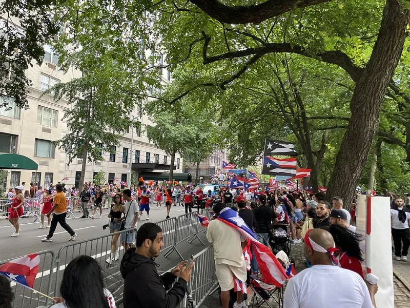
Photo: Deans Charbal, CC BY-SA 4.0, via Wikimedia Commons
Tell a Puerto Rican you're from, say, New Britain, Connecticut, and there's a decent chance the response is: "My cousin lives there." It's not a coincidence. It's geography.
More than five million people of Puerto Rican descent live in the fifty states — a larger population than the island itself. The diaspora didn't scatter randomly. It followed migration corridors shaped by economics, chain migration, and, in several cases, deliberate recruitment programs. Once you see the map, the "small world" feeling stops being a mystery.
The Corridors That Built the Map
The Connecticut River Valley. Hartford and its satellite towns — New Britain, Bridgeport, Springfield just over the line — became one of the densest Puerto Rican enclaves in the country, seeded by mid-century agricultural and tobacco work. Hartford's Puerto Rican population is among the highest per capita of any major US city.
Central Florida. Orlando's Puerto Rican community exploded in recent decades, driven partly by direct flights, partly by displacement after Hurricane Maria, and partly by the simple gravitational pull of established communities. Some observers note that Central Florida's Puerto Rican population has grown to rival the island's own metro areas.
The New York Legacy. The classic corridor — farm work contracts, then factory jobs in Brooklyn, the Bronx, and East Harlem — is the historical trunk from which most other branches grew. Second and third generations have since fanned out to the Poconos, the Lehigh Valley, and beyond.
The Midwest Anchor. Chicago's Humboldt Park remains the diaspora's great inland landmark, its Puerto Rican identity stamped onto streets, festivals, and one very famous pair of steel gates.
Why It Matters for Travelers and Teachers
For educators, the diaspora map is a living lesson in cultural geography: push factors (economic contraction, storms), pull factors (jobs, family), and the network effects that make certain cities magnets. For travelers heading to the island, it's a conversation starter — mention your metro area, and you'll likely find a connection within minutes.
For businesses, the practical takeaway is that "the Puerto Rico market" doesn't stop at the shoreline. It runs along the I-4 corridor in Florida, up the Connecticut River, and through a hundred other zip codes.
An Island That Never Fully Left
Geography usually means landforms and distances. But Puerto Rico's geography extends into mainland neighborhoods — the bodegas in Bridgeport, the festivals in Chicago, the direct flights from Orlando to Aguadilla. The island's shoreline is a border, but a famously porous one, crossed so many times in both directions that the map of Puerto Rico now includes a few dozen US cities, drawn in all but name.