Packed Into Every Acre: How Puerto Rico Became a Biodiversity Hotspot With No Room Left to Spare
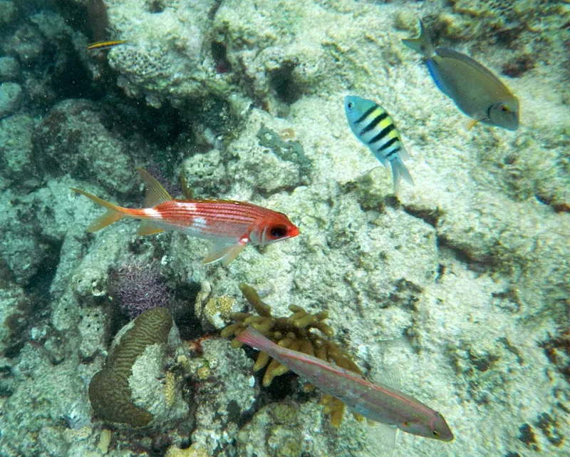
Photo: doreen ODonovan, CC BY-SA 2.0, via Wikimedia Commons
Puerto Rico is roughly the size of Connecticut. That comparison usually lands as a fun fact, a quick way to frame the island for an American audience unfamiliar with its dimensions. But here's the part that rarely follows: Connecticut has around 2,600 known plant species. Puerto Rico has more than 3,500 — and that's before you count the insects, birds, reptiles, and marine life that make the island one of the most ecologically dense places in the entire Atlantic basin.
So what's going on? How does a small island in the northeastern Caribbean end up outpacing much larger landmasses in the sheer variety of life it supports? And more urgently — if the island is so rich, why are so many of its species teetering on the edge?
The answers are geographic, geological, and deeply tied to how humans have used — and continue to use — this land.
An Island Built for Diversity
Start with location. Puerto Rico sits at the northeastern corner of the Caribbean island arc, positioned almost exactly where the Atlantic Ocean and the Caribbean Sea meet. That placement makes it a natural waypoint for migratory species moving between North America and South America. Birds, bats, and insects have been stopping here for millions of years, and some of them stayed. Over time, populations isolated on the island evolved into entirely new species found nowhere else on Earth — what biologists call endemic species.
The island currently hosts over 230 endemic plant species, dozens of endemic reptiles, and birds like the Puerto Rican parrot, which exists in the wild only here. That level of endemism is typically associated with much larger landmasses or islands that have been isolated for tens of millions of years. Puerto Rico checks both boxes in its own way: it's old enough geologically to have allowed significant evolution, and its central mountain range — the Cordillera Central — creates enough climatic variation to support radically different ecosystems within short distances.
That mountain range is key. It forces moisture-laden trade winds upward, wringing out rainfall on the northern and eastern slopes while leaving the south comparatively dry. The result is a patchwork of cloud forests, dry coastal scrub, karst limestone terrain, and mangrove networks — all compressed into an island you can drive across in under two hours. More habitat types in a small area means more ecological niches, and more niches means more species can coexist without directly competing.
The Geological Backstory
Puerto Rico's biodiversity didn't emerge in a vacuum. The island rose from volcanic activity and tectonic uplift, and its limestone karst region in the north — the same one that produces the famous mogotes, those rounded green hills — created a completely distinct underground and surface ecosystem. Caves, sinkholes, and subterranean rivers support species adapted to total darkness and mineral-rich water. Some of these cave-dwelling organisms are found in just one or two specific locations on the island and nowhere else on the planet.
The surrounding marine environment adds another layer. Puerto Rico's coastal waters include coral reef systems, seagrass beds, and deep-ocean trenches — the Puerto Rico Trench is the deepest point in the entire Atlantic. That underwater geography supports marine biodiversity that complements the terrestrial picture, with sea turtles, reef fish, and migratory whales all using Puerto Rican waters as feeding and breeding grounds.
All of this happened over millions of years of geological and ecological time. The problem is that what took millions of years to build can be erased in a matter of decades.
The Squeeze: What's Actually Threatening the Habitat
Here's where the geography starts working against itself.
Puerto Rico's population is concentrated along the coast and in the metropolitan area surrounding San Juan. Coastal development has been intense for decades — hotels, condominiums, marinas, and roads have replaced mangrove forests and seagrass beds at a rate that has alarmed marine biologists. Mangroves in particular are critical nursery habitat for reef fish and act as buffers against storm surge, but they're also prime real estate. The island has lost a significant portion of its historic mangrove cover since the mid-20th century.
Inland, the pattern shifts but the pressure doesn't. Agricultural land that was abandoned during Puerto Rico's industrial shift in the 1950s and 60s allowed secondary forest to regrow across much of the island — a genuine ecological success story. But that forest is now facing new pressure from suburban expansion. San Juan's metropolitan footprint has been growing outward for years, converting what was recovering forest into subdivisions and commercial strips. The forests that came back are young and fragmented, which means the species that depend on large, continuous habitat — certain bird species, larger mammals, and wide-ranging reptiles — still don't have enough room.
Fragmentation is a word that comes up constantly in conservation biology, and it's worth understanding what it actually means on the ground. When a forest is broken into smaller patches by roads and development, species that need to move between patches — to find food, mates, or seasonal resources — can't do it. The patches become islands within the island. And just like oceanic islands, smaller habitat islands support fewer species over time. Local extinctions quietly accumulate.
The Karst Region Under Pressure
The limestone karst belt running across Puerto Rico's northern interior deserves special attention. It's one of the most biologically significant landscapes on the island, home to endemic cave species, the last remaining wild habitat of the Puerto Rican parrot, and forest ecosystems that took centuries to develop over thin, rocky soil.
It's also been subjected to quarrying, agricultural use, and residential development that has steadily reduced its extent. Karst terrain is slow to recover. When the thin forest layer is removed, the underlying limestone erodes quickly, and the cave systems below can be damaged by changes in water infiltration. What looks like open land on a map can represent an irreversible loss of something that took geological time to create.
What This Looks Like as a Case Study
For US readers thinking about conservation in terms of national parks and wilderness areas, Puerto Rico offers a different kind of lesson. This isn't about protecting a single large landscape. The island's biodiversity is woven into a mosaic of small, varied, and often privately owned habitats — a patch of cloud forest here, a coastal wetland there, a limestone cave system tucked behind a strip mall. Protecting it requires a different set of tools: land-use regulation, private conservation easements, urban planning that accounts for ecological corridors, and coastal zoning that actually holds.
Some of that work is happening. The Puerto Rican parrot recovery program has been one of the more remarkable conservation efforts in US territory history. Marine protected areas have been established around key reef systems. Conservation organizations are working with landowners to maintain forest cover on private land.
But the math remains uncomfortable. Puerto Rico has more species per square mile than almost anywhere in the United States, and less protected land per capita than most US states. The island's geography created an extraordinary concentration of life. The question now is whether its land-use decisions will honor that inheritance or continue to spend it down, acre by acre, in ways that can't be undone.