Altitude on Your Plate: How Puerto Rico's Terrain Decides Every Bite You Take
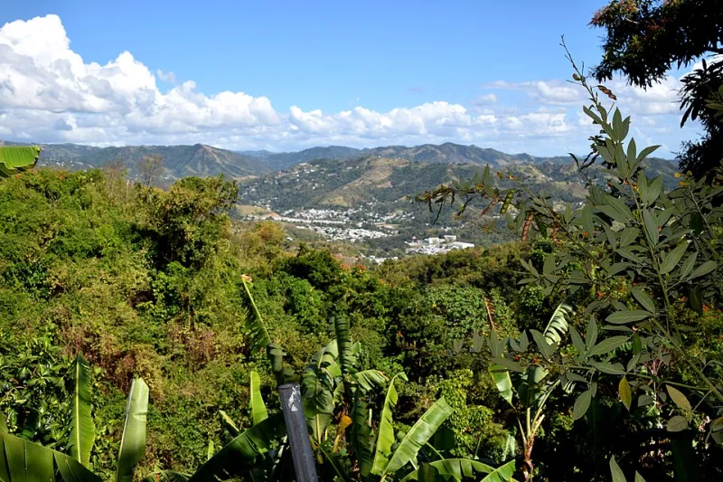
Photo: Tony Alter, CC BY 2.0, via Wikimedia Commons
Pull up a satellite image of Puerto Rico and you'll notice something immediately: this isn't a flat island. A rugged spine of mountains — the Cordillera Central — runs east to west like a backbone, flanked by coastal plains, karst hills, and river valleys that each create their own little world. That dramatic variation in elevation, which climbs from sea level to over 4,000 feet at Cerro de Punta, isn't just a geography lesson. It's a recipe book. The terrain determines rainfall, temperature, soil type, and sun exposure — and those factors, stacked together, decide what grows where. In Puerto Rico, the map and the menu are essentially the same document.
The Coastal Lowlands: Where the Sweetness Starts
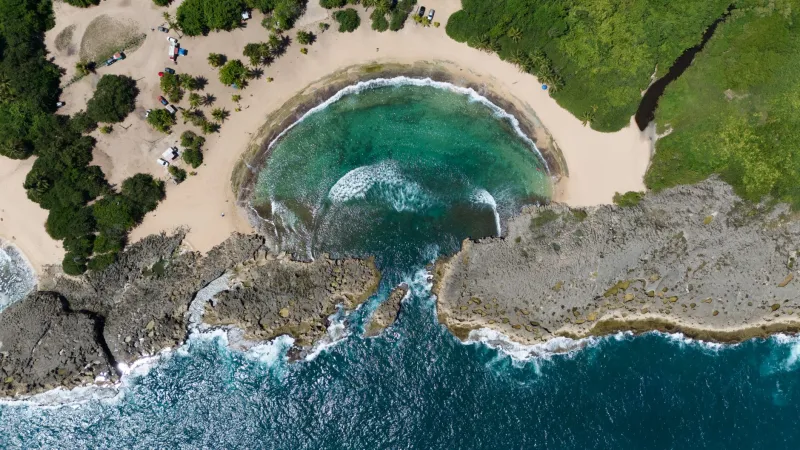
Start at the edges of the island and you're in flat, warm, historically sugar-soaked territory. The coastal plains — especially along the southern and northern coasts — sit at low elevations where temperatures stay high and soils tend toward clay-rich, moisture-retaining profiles. For centuries, this was sugar cane country. The industry is largely gone now, but the agricultural identity of these zones hasn't disappeared entirely.
Today, the northern coastal lowlands produce a variety of tropical crops that need consistent heat and humidity: plantains, yuca (cassava), and various root vegetables like ñame and malanga. These starchy staples are the foundation of Puerto Rican cooking — the base of sancocho, the side dish at every family table, the ingredient that shows up in everything from pasteles to mofongo. They grow here because the terrain lets them. Low elevation means warm nights, which is exactly what tropical root crops need to develop properly.
The southern coast tells a different story. Drier and sunnier due to the rain shadow cast by the central mountains, this region has historically supported crops that tolerate drought, including some citrus and, more recently, solar farms replacing what were once irrigated fields. The geography there is less about rainfall and more about engineered water — a reminder that human decisions layer on top of natural ones.
The Foothills: A Transition Zone with Its Own Identity
Climb a few hundred feet above the coastal plain and the air changes noticeably. Temperatures drop a few degrees, humidity picks up, and the vegetation shifts. This transitional zone — roughly 500 to 1,500 feet in elevation — is where Puerto Rico's agricultural middle ground lives, and it's arguably the most diverse farming belt on the island.
Piñones is coastal, but head inland through Caguas or into the hills around Orocovis and you start finding a patchwork of small farms growing everything from avocados and mangoes to sweet peppers and herbs. The foothills of the Cordillera Central are home to many of Puerto Rico's agricultores who supply local markets and farm-to-table restaurants in San Juan. The elevation is high enough to moderate heat stress on plants, but low enough to avoid the cloud cover that blankets the upper peaks.
This is also where you start seeing coffee appear — not the prime stuff, but the early entries into a crop that defines the island's mountain identity. The foothills are a preview of what the higher terrain does even better.
Mountain Coffee and the Geography of Flavor
Ask any Puerto Rican about the island's coffee and they'll point you toward the mountains. Specifically, toward towns like Yauco, Lares, Las Marías, and Jayuya — municipalities that sit between roughly 1,500 and 3,500 feet above sea level in the heart of the Cordillera Central. This isn't coincidence. It's geography doing its job.
Coffee plants are famously finicky. They need consistent temperatures (not too hot, not too cold), well-drained soil, partial shade, and reliable but not excessive rainfall. The central mountain range delivers all of this in a package that lowland zones simply can't replicate. Cloud cover at higher elevations slows the maturation of coffee cherries, which actually intensifies flavor — a process that coffee growers worldwide call "slow ripening" and consider a mark of quality.
Puerto Rican mountain coffee, once exported to the Vatican and the Spanish royal family in the late 1800s, carries the fingerprint of its elevation in every cup. The geography creates what wine drinkers would call terroir — a French term that has no perfect English equivalent but basically means "the taste of a place." The soil composition, the mist, the altitude-driven temperature swings between day and night — all of it ends up in the flavor profile. You're not just drinking coffee when you order a cup from Yauco. You're drinking a specific hillside.
El Yunque and the Wet Side: A Different Kind of Abundance
Shift to the northeastern corner of Puerto Rico and the geography shifts dramatically. El Yunque National Forest — the only tropical rainforest in the U.S. National Forest system — sits at elevations ranging from near sea level up to about 3,500 feet, and it receives anywhere from 100 to 200 inches of rainfall per year depending on elevation. That's an almost incomprehensible amount of water.
The communities surrounding El Yunque, particularly in the municipalities of Luquillo and Río Grande, have historically benefited from that moisture in agricultural terms. The area is known for producing some of the island's best root vegetables and tropical fruits. The lush, wet conditions that make the forest so biodiverse also make the surrounding farmland exceptionally productive for crops that love moisture — breadfruit, various banana cultivars, and leafy vegetables that would wilt in the drier south.
Luquillo is also home to one of Puerto Rico's most famous food destinations: the kioscos, a strip of roadside food shacks near the beach that serve everything from alcapurrias (fried fritters stuffed with meat) to fresh seafood. That combination — mountain-fed agricultural richness meeting coastal seafood culture — is itself a geography story. The rivers running out of El Yunque have historically supported freshwater species, and the proximity to the Atlantic keeps the seafood supply close.
The Coast Comes Back: Fishing Zones and the Blue Economy
Come back down to sea level and the food map shifts entirely from soil to water. Puerto Rico's coastline stretches roughly 700 miles, and the fishing communities scattered along it — from Cabo Rojo in the southwest to Fajardo in the northeast — each have geographic identities tied to ocean conditions, reef proximity, and current patterns.
The southwestern shelf, around Cabo Rojo and La Parguera, sits near extensive coral reef systems and shallow banks that support a rich marine ecosystem. Local fishers there have traditionally targeted red snapper, grouper, and lobster — species that depend on healthy reef habitat. The northeastern coast, influenced by the Atlantic and closer to deep-water channels, sees different catch profiles. Geography, even underwater, creates specialization.
Seafood in Puerto Rico isn't just a coastal preference — it's a coastal necessity shaped by what the surrounding waters actually produce. When you order chillo (red snapper) at a restaurant in Ponce, you're eating a fish whose availability is determined by the reef geography of the southern shelf. The plate is a map.
Reading the Menu Like a Geographer
The next time you sit down at a Puerto Rican restaurant — whether you're on the island or at a spot in Orlando, New York, or Chicago — try reading the menu differently. The mofongo made with mountain plantains, the café de altura brewed from Yauco beans, the fresh red snapper from the southwestern reefs: every ingredient carries a geographic address.
Puerto Rico's food culture is often celebrated for its flavor, its history, and its community roots. All of that is real and worth celebrating. But underneath the cultural story is a physical one — a story of elevation gradients, rainfall patterns, soil types, and ocean currents that have been quietly deciding what ends up on the table for centuries. The island's terrain is the original chef, and it's been running the kitchen the whole time.