Left Behind and Coming Back: The Forgotten Communities That Tell Puerto Rico's Real Story
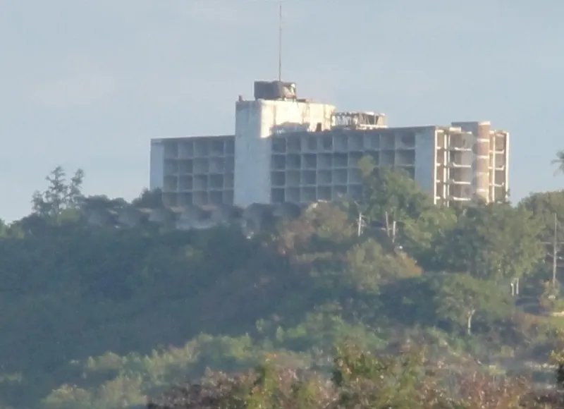
Photo: Tito Caraballo, CC BY-SA 2.0, via Wikimedia Commons
Not every place on a map is a place people still live. Puerto Rico has its share of communities that exist today mostly as memory — overgrown foundations, rusted machinery half-swallowed by vegetation, church steps that lead to nothing. But here's the thing about those places: they didn't empty out randomly. Geography had a hand in almost every one of those stories.
And now, in some of those same communities, geography is playing a role in bringing people back.
How a Place Thrives or Dies: It Usually Starts With the Land
To understand why certain Puerto Rican communities grew into towns while others faded, you have to think about what the land offered — and what it didn't.
In the 19th and early 20th centuries, the lowland coastal plains and the gentler river valleys were where the sugar economy took root. Towns like Aguirre, in the municipality of Salinas, grew up almost entirely around the sugar industry. At its peak, Aguirre had a company-owned hospital, a school, a golf course, and housing for thousands of workers. It was a fully functioning town — but one that existed entirely to serve a single crop.
When the sugar industry collapsed through the mid-20th century — squeezed out by cheaper production elsewhere and shifting US agricultural policy — towns like Aguirre had no backup plan. The company pulled out, the jobs disappeared, and the people followed. What's left today is a haunting collection of structures slowly being reclaimed by mangroves and coastal scrub. The geography that made Aguirre valuable for sugar (flat land, proximity to the coast for shipping) couldn't save it once the economics changed.
The Mountains Had Their Own Logic
While the lowlands were shaped by sugar, Puerto Rico's interior mountains — the Cordillera Central — developed their own pattern of settlement. Coffee was king in the highlands, and the cool, misty elevations that made life harder in some ways made arabica coffee thrive.
Communities in municipalities like Yauco, Lares, and Maricao grew around the coffee economy, and some of those barrios — the small sub-municipal communities that are the basic unit of Puerto Rican rural life — were quite isolated. Roads were poor or nonexistent. Medical care was distant. Education was limited.
When Operation Bootstrap, the mid-century industrialization program, began pulling Puerto Ricans toward factory jobs in San Juan and eventually toward the US mainland, mountain barrios emptied out steadily. Young people left for Ponce, for San Juan, for New York. The elderly stayed. And then they didn't.
Some of those highland communities are now genuinely ghost towns — places where the census counts fewer than a dozen residents, where the old wooden houses lean and rot, where the coffee terraces are invisible under decades of secondary forest growth.
What Hurricane Maria Revealed
The 2017 hurricane didn't create vulnerability in Puerto Rico's rural communities — it exposed it. When Maria hit, the most isolated mountain barrios were also the most cut off from emergency relief. Some communities in the interior went weeks without contact, power, or clean water.
But Maria also revealed something else: the people who had stayed in these remote places were extraordinarily resilient. Communities that had been written off as dying showed an ability to organize, share resources, and rebuild that surprised outside observers. The geography that made them vulnerable also, in some ways, made them tight-knit.
In the aftermath, a number of these communities became the focus of both grassroots revival efforts and outside investment. Organizations began asking a question that would have seemed strange a decade earlier: could rural Puerto Rico actually be repopulated?
New Reasons to Come Back
Geography that once pushed people away is now, for some, a selling point.
The same mountain isolation that made highland barrios economically marginal in the industrial era is now attractive to people seeking slower lifestyles, agricultural opportunity, and affordable land. A small but growing movement of younger Puerto Ricans — and some diaspora Puerto Ricans returning from the mainland — are moving into rural municipalities, buying or inheriting land, and starting small farms, agrotourism operations, and creative businesses.
In Adjuntas, an organization called Casa Pueblo has spent decades turning the community's geographic identity — its forests, its rivers, its mountain character — into an economic and cultural asset. They fought off open-pit mining proposals, developed community solar energy, and built an ecotourism model that draws visitors specifically because the place has stayed wild. Geography, once a liability, became the brand.
Similar stories are playing out in Utuado, in Ciales, and in corners of Lares where coffee is staging a modest comeback — not as a mass commodity, but as a specialty product that fetches premium prices precisely because of where it's grown.
Coastal Communities and the Heritage Economy
The coast has its own version of this story. Some of Puerto Rico's smaller coastal fishing villages were bypassed by resort development that concentrated in places like Condado and Isla Verde. That bypass left them poorer in the short term, but it also left them more authentically themselves.
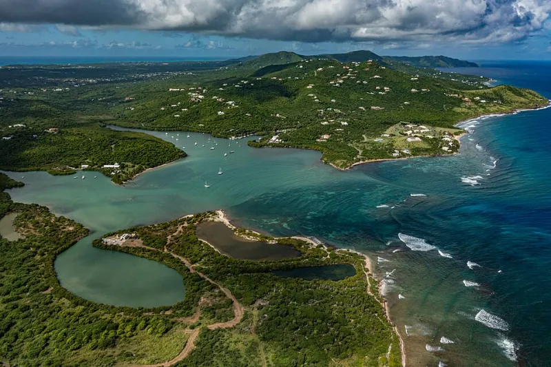
Communities like La Parguera in Lajas or Boquerón became known for their character — their fishing culture, their bioluminescent bays, their local seafood. Visitors seeking something beyond the resort corridor started finding their way there. The geography that kept big development out became the thing that made them worth visiting.
There are tensions in this, of course. Rising property values price out the fishing families who gave these places their identity. Short-term rental platforms accelerate that displacement. The revival of a place and the survival of its original community aren't always the same thing, and that's a human geography challenge Puerto Rico is actively wrestling with.
Reading the Landscape Like a Map of History
One of the most interesting things about traveling through Puerto Rico's rural areas is how much history is written into the landscape itself. A row of royal palms usually marks where a hacienda once stood. A flat, treeless patch in the middle of secondary forest is often an old cane field. A cluster of mango trees in the middle of nowhere means someone's house was there once.
Those landscape clues are the physical record of economic and demographic forces — of booms and busts, migrations and returns, decisions made in Washington and New York that rippled out to mountain barrios and coastal fishing villages.
The communities that didn't make it onto tourist maps or development plans aren't failures. They're evidence. Evidence of how geography and economy interact, how people adapt when the ground shifts under them — literally and figuratively — and how a culture can survive in unexpected places.
Puerto Rico's abandoned villages aren't just ruins. They're chapters in an ongoing story, and some of them are getting new endings.