Nothing Stays Put: The Slow, Relentless Reshaping of Puerto Rico's Geography
Pull up any map of Puerto Rico and it looks exactly like what you'd expect—a fixed, rectangular island sitting neatly in the northeastern Caribbean. Stable. Defined. Permanent. But spend any time talking to geologists, coastal engineers, or longtime residents near the water, and a very different picture starts to emerge. Puerto Rico isn't sitting still. It never has been.
The island is part of one of the most geologically active zones in the entire Atlantic basin, and the evidence of that activity isn't just buried in rock layers or visible only through scientific instruments. It shows up in crumbling sea cliffs, repositioned property lines, flooded roads that didn't used to flood, and beach communities that are quietly losing ground—sometimes literally.
Riding the Caribbean Plate
To understand why Puerto Rico moves, you have to zoom way out. The island sits on the northeastern edge of the Caribbean Plate, which is grinding westward relative to the North American Plate at a rate of roughly 20 millimeters per year. That might sound trivial, but over decades and centuries, those millimeters add up to something geologically significant.
This plate boundary runs through the Puerto Rico Trench—the deepest point in the entire Atlantic Ocean, sitting just north of the island at nearly 28,000 feet deep. The trench isn't just a geographic curiosity. It's the scar left by ongoing tectonic collision, and it generates the seismic activity that Puerto Ricans feel regularly. The January 2020 earthquake sequence, which peaked at a 6.4 magnitude and caused widespread destruction in the southwestern part of the island, was a direct consequence of stress building along these plate boundaries.
But earthquakes aren't the only way tectonic forces reshape the island. Slow, continuous movement causes subtle ground deformation—areas that rise slightly over decades, others that sink just enough to change how water drains, where roads crack, and how close sea level feels to a neighborhood that once sat comfortably above the tide line.
The Shoreline That Keeps Changing Its Mind
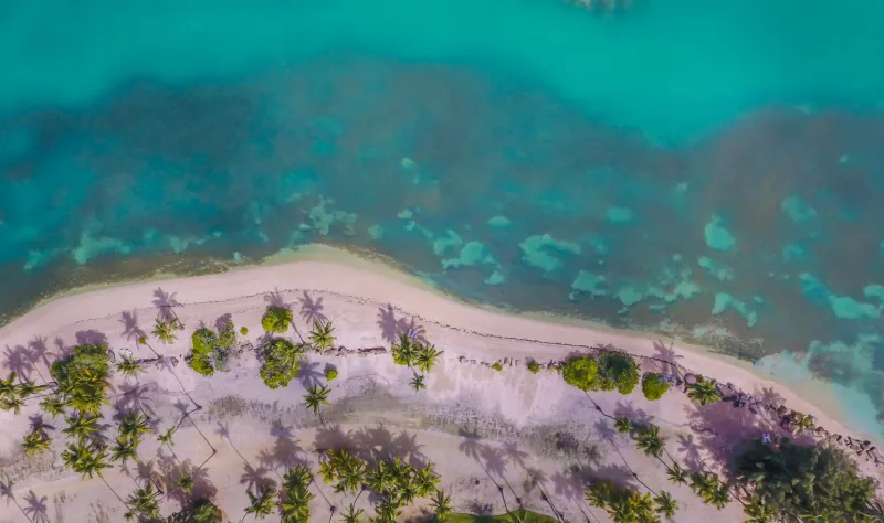
If tectonic shifts operate on a scale most people can't perceive day to day, coastal erosion is far more visible—and far more immediate. Puerto Rico's coastline has been retreating in many areas for decades, driven by a combination of sea level rise, storm impact, and the loss of natural buffers like mangroves and coral reefs.
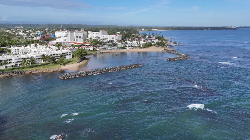
The U.S. Geological Survey has documented significant erosion along stretches of the island's north and east coasts. Some beaches have lost tens of feet of width over the past 50 years. In certain areas near Loíza and along the Isla Verde corridor in San Juan, the gap between the water and developed land has narrowed to the point where infrastructure built decades ago now sits uncomfortably close to the surf.
What makes this especially complicated is that erosion doesn't happen evenly. One stretch of coast might be losing sand while a neighboring beach is actually accreting—gaining material deposited by longshore currents. The net result is a coastline that looks different depending on where you're standing and when you measured it last.
For property owners, this creates a genuinely strange legal situation. In Puerto Rico, as in most U.S. jurisdictions, property lines are tied to fixed coordinates established at the time of survey. But when the land those coordinates describe has eroded into the ocean, or when new land has been deposited in front of an old boundary, the legal map and the physical reality stop matching. It's a problem that coastal attorneys and municipal planners deal with more often than most people would guess.
Mountains That Aren't Quite Where They Used to Be
The interior of the island isn't immune to change either. The Cordillera Central, Puerto Rico's mountainous spine, experiences regular landslides—particularly after heavy rainfall. These aren't just dramatic, newsworthy events. Smaller, slower slope movements called creep can gradually shift hillside terrain over years, displacing roads, cracking foundations, and subtly altering drainage patterns.
After Hurricane Maria in 2017, satellite imagery and field surveys documented thousands of landslide scars across Puerto Rico's mountainous interior. Many of those slopes are still stabilizing. Some roads in the highlands were rerouted entirely because the ground beneath the original path had moved too much to be safely rebuilt in the same location.
Geodetic surveys—precise measurements of the Earth's surface—have also shown that certain parts of Puerto Rico experience measurable vertical land movement. Some coastal zones are subsiding, sinking slowly due to groundwater extraction, sediment compaction, or tectonic forces. When you combine even a few millimeters of annual subsidence with rising sea levels, the effective rate of relative sea level rise in those areas is noticeably higher than the global average.
What This Means for Infrastructure and Planning
None of this is abstract science. The practical consequences show up in how the island builds, plans, and recovers.
Infrastructure decisions made based on 1970s surveys are now being stress-tested by a geography that has measurably shifted. Flood zone maps that haven't been updated in years may no longer reflect actual risk. Buildings permitted based on old property lines may now sit in different relationships to the shoreline than originally intended.
After the 2020 earthquakes, engineering teams discovered that some areas in the southwest had experienced ground subsidence significant enough to affect drainage infrastructure. Streets that once shed water now pool it. That's not just an inconvenience—it accelerates road deterioration and creates new mosquito breeding grounds in communities already dealing with recovery.
For urban planners and municipal governments, the challenge is enormous. Updating surveys, revising flood maps, and rethinking development guidelines all require resources and political will that are often in short supply. But the alternative—continuing to plan as if the island's geography is static—carries its own costs, usually paid after the next storm or seismic event.
Geography as a Living System
There's something almost philosophical about all of this. We tend to think of maps as truth—as accurate snapshots of a fixed reality. But Puerto Rico is a reminder that geography is better understood as a process than a picture. The island is the current result of millions of years of tectonic movement, erosion, deposition, and biological activity. And it will look different a hundred years from now than it does today.
That's not a reason for alarm, exactly. It's a reason for humility and attention. The communities most vulnerable to these changes—coastal neighborhoods, mountain towns on unstable slopes, low-lying areas experiencing subsidence—deserve updated data, honest risk assessments, and infrastructure investments that account for the ground beneath them actually moving.
Puerto Rico isn't going anywhere, in the big sense. But in the very literal, very measurable sense, parts of it absolutely are. And the sooner that reality is built into how the island plans its future, the better prepared those communities will be when the ground—as it inevitably does—shifts again.